A piece of the world’s oldest unsolved puzzle, a 2,200-year-old map of Rome made up of thousands of marble pieces, has finally been fitted.
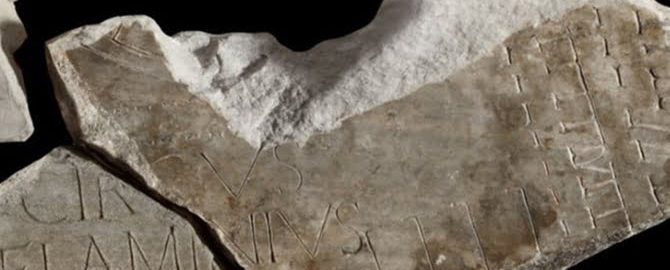
A new map fragment bearing the inscription ending with the phrase “Circus Flaminius” was finally matched with a large part of the find first discovered in 1562. To this day, nearly 1,200 other fragments have been found.
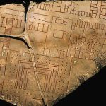
The map known as Forma Urbis Romae, was carved in marble between 203 and 211 CE. during the reign of Septimius Severus. To this day, only fragments that are kept in the Capitoline Museum have survived. The remains of the map make up only 10% of the entire original map that once stood on the wall of the Temple of Peace (Templum Pacis).
The wall is still standing in the building near the sixth-century church, which today is part of the basilica complex of St. Kosma and Damian. The row of holes where the map was attached with bronze clamps is still visible.
The map was carved on 150 marble slabs. Its original width was 18 meters and the height was 13 meters. It was made on a scale of approximately 1: 240 and was accurate enough to show floor plan views of almost every temple, insula, or thermal bath in the centre of Rome. The boundaries of the plan were apparently determined by the available marble surface, and not by geographic or political boundaries, as is usual on contemporary maps (plans). It contains names and detailed plans of public buildings, streets and private houses. The creators used markings along with details such as columns or stairways.
So far, the biggest problem is putting the great map of Rome together. Still many of the fragments do not fit the whole thing. The fragment was discovered in 2014 in Palazzo Maffei Marescotti, a building owned by the Vatican. By linking it to a map, three other fragments were added. This way, scientists are able to read part of the blueprint more accurately.
The attached piece of the map refers to the 31st plate showing the then Roman ghetto where Circus Flaminius was located, founded in 220 BCE. The plebeian games also took place there.


