

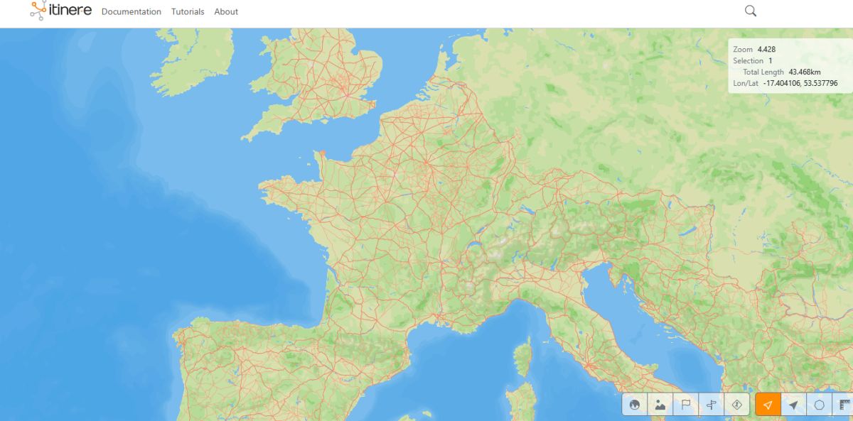
Scientists from Spain and Denmark, as part of the Itiner-e project, have created a unique electronic map of Roman roads, covering 299,171 km.
They then located these routes in space by comparing the obtained information with modern and historical topographic maps, aerial photographs (including those from U.S. Air Force missions in the 1950s), current satellite images, and historical photographs from the Corona program (1967-1972). The latter resource was essential for areas now flooded by modern reservoirs. Finally, they manually digitized each segment at a spatial resolution of 5 to 10 … 200 meters, reflecting the actual terrain: winding mountain passes, valleys, and natural corridors, rather than straight lines.
The result was 14,769 road sections organized according to a two-level hierarchy:
- Main roads (103,477.9 km, 34.58% of the total), documented by milestones or historical sources, which served as the structure of the imperial administration and army.
- Secondary roads (195,693.3 km, 65.42%), which testify to local and regional mobility.
The project also generated maps illustrating areas where data are lacking and where future research could focus on expanding the mapped routes. […]
The map also reveals significant gaps in current knowledge: areas with poor data include northern England, Cornwall, the Middle and Upper Danube, Tuscany, Corsica, and central Anatolia. These areas are prioritized for future research campaigns. Furthermore, the project identified the deserts and mountainous regions of North Africa as areas posing the greatest challenges in terms of documentation.1


