This page cannot be viewed in frames

Go to page

If you have found a spelling error, please, notify us by selecting that text and pressing Ctrl+Enter.

Latest study by scientists – map of Roman roads and modern light intensity at night

This post is also available in: Polish (polski)

Map showing Roman roads

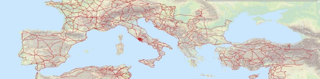
The latest study by scientists aimed to map the Roman road network and modern light intensity at night. Then the map was divided into grids, and a comparison of Roman roads with the current infrastructure, population and economy was undertaken.

As the researchers point out, it is striking how many modern cities and economic centres are located on former Roman roads, which have been replaced by modern, often high-speed roads. Even after the fall of the Empire in the west, the cities along the roads survived.

The study was published in the Journal of Comparative Economics 50 under the title Roman roads to prosperity: Persistence and non-persistence of public infrastructure.

Sources

IMPERIUM ROMANUM needs your support!

If you like the content that I collect on the website and that I share on social media channels I will be grateful for the support. Even the smallest amounts will allow me to pay for further corrections, improvements on the site and pay the server.

Support IMPERIUM ROMANUM!

Support IMPERIUM ROMANUM!

Find out more!

Check your curiosity and learn something new about the ancient world of the Romans. By clicking on the link below, you will be redirected to a random entry.

Random curiosity

Random curiosity

Discover secrets of ancient Rome!

If you want to be up to date with newest articles on website and discoveries from the world of ancient Rome, subscribe to the newsletter, which is sent each Saturday.

Subscribe to newsletter!

Subscribe to newsletter

Spelling error report

The following text will be sent to our editors: