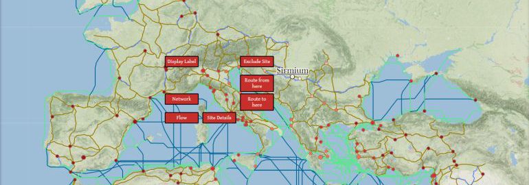
On the ORBIS website was launched an project “Stanford Geospatial Network Model of the Roman World”, which will allow us to find out how long it took and how much it cost to travel in Roman times.
The map includes the Roman Empire around 200 CE, including 632 places: well-known Roman urban centers, ports, fortifications and several mountain passages. The map covers an area of 10 million square kilometers, about 84,630 km of roads and 28, 271 km of waterways.
You can also analyze the route for different types of transport: wagons harnessed by oxen, mules, horses (travelers as well as those used for fast movement). You can also see how much it would take to cover the route in a regular army march. There are 14 different types of travel.
In sea transport, various factors are taken into account, eg. strong winds, wave height or sea currents. The map also took into account 25 rivers, where the course of the river and local winds are important.
For example, according to estimates, the fastest route between Eburacum (York in England) and Rome was around 3276 km and could be covered within around 30 days. If the Roman wanted to travel in the best conditions and on the fastest ship, it cost him about 1063, 6 denarii (equivalent to today’s 21,300 dollars). For comparison, the emperor Septimius Severus, raised in 197 CE paid to legionaries (by about 50%), which eventually amounted to 450 denarii per quarter, and 1800 denarii a year.
Map of the Roman Empire, which allows you to calculate travel time and costs


